


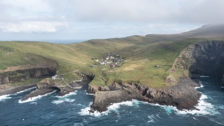
Gásadalur (Danish: Gåsedal) is a village located on the west side of Vágar, Faroe Islands, and enjoys a panoramic view over to the island of Mykines.
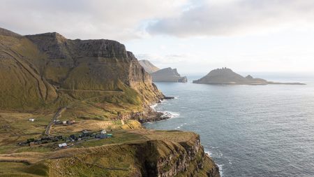
Gásadalur is located on the edge of Mykinesfjørður, surrounded by the highest mountains on Vágar. Árnafjall towers to a height of 722 metres (2,369 ft) to the north, and Eysturtindur to the east is 715 metres (2,346 ft). Here too, the view south to Tindhólmur and Gáshólmur is quite magnificent. Eysturtindur translates to English as “the Peak in the East”.[2]
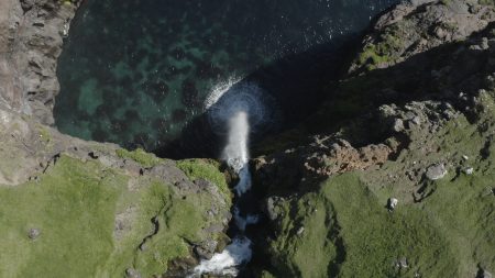
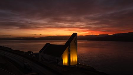
The boat landing site is very poor, because it is located somewhat higher than the seashore. So if the residents wanted to fish, they were obliged to keep their boats near Bøur. In 1940, during the British occupation of the Faroe Islands, a stairway was built from the beach up to the village.
In order to reach any of the other villages by land, residents had to take the strenuous route over mountains more than 400 metres (1,300 ft) high. This isolation explains why the village population had decreased. In 2002, there were only sixteen people living in Gásadalur, and several of the houses stand empty today. It had a population of 18 in 2012.[3] It had a population of 11 in 2020.
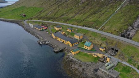
In 2004, the Gásadalstunnilin tunnel was blasted through the rock, and it became possible to drive through by car. The residents hope this will mean that the village population will increase again. While the population increased briefly and reached a peak of 23 in 2010 it has only decreased since then and is at only 11 as of 2020. There are good opportunities for farming, and the same number of fields as in Bøur, but here only a few are royal estate, while most of them are freehold land.
Gásadalur belong to the municipality of Sørvágur which is located on the same island as the national airport.
Sørvágur (Danish: Sørvåg) is a village on the island of Vágar in the Faroe Islands.
It is located at the landward end of Sørvágsfjørður. Sørvágur is the largest village in Sørvágur Municipality.
Name
The name Sørvágur translates to “The Bay of Sør”. While the second half of the name makes sense given the fact that the village is located at a bay, the first half is more mysterious. Legend has it that the first man to settle at this place was called ‘Sørli’ and hence the village was named in honour of him. Another explanation on the origin of ‘Sør’ comes from the old-Norse ‘Seyr’ which is a word for sand (seyr is also a word for foggy rain). Sørvágur has quite a large sandbeach in comparison with other Faroese villages and towns, and therefore it was speculated that the original name of Sørvágur was Seyrvágur, and during the course of time, Seyrvágur became Sørvágur. During the first half of the 20th century, local people in Sørvágur tried to correct this historical injustice and used the name Seyrvágur instead of Sørvágur. However, this trend died out again. One reason may be that there is no proof in the Faroese historical records that justifies the name Seyrvágur.
First settlement
Sørvágur is considered to be one of the oldest villages in the Faroe Islands. In 1957, the locals decided to build a new school, and during the preparations to build the school’s gymnastic hall, they excavated an old Viking settlement. Sørvágur – alongside Leirvík, Tjørnuvík and Sandur – is one of the few places in the Faroe Islands where archaeologists have been able to find substantial proof that these places were built during the first 100–150 years after the Faroese Landnám in 825.
Even though the village is old, there is no mention of it, or the island of Vágoy, in the old Faeringa Saga from the thirteenth century.


Reviews
There are no reviews yet.