
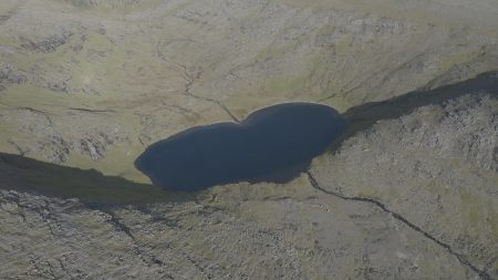


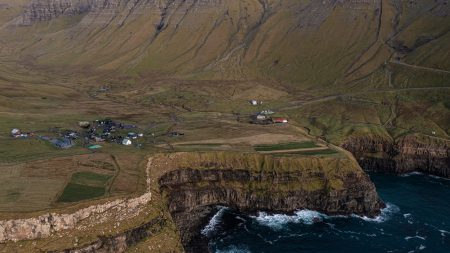
Vatnsdalsvatn is the 3rd largest lake on Vágar. Situated in a valley by the village Bøur, it is relatively easy to get to, although the climb up is steep. The hike would start by the stream “Breiðá” halfway between Bøur and Sørvágur. It takes roughly an hour to hike up to the lake.
On the map, Vatnsdalsvatn appears completely heartshaped, though, the changes in the coast around it over the years has morphed it slightly. This makes it ideal for a romantic hike, and many a couple has had their photo taken with the heartshaped lake in the background. Don’t forget to look around you though, because from the same spot where you will get the picture of the heartshaped lake, you will also get a fantastic panoramic view of the west coast of Vágar, including Tindhólmur and Mykines.
The Faroe Islands are a self-governing territory of Denmark located in the North Atlantic Ocean. With Europe’s highest sea cliffs, sublime fjords, and abundant wildlife, the islands are a trove of raw natural beauty and adventure. There are 433 named mountains; the highest and most prominent mountain is Slættaratindur (880 m/2,887 ft).
Geography
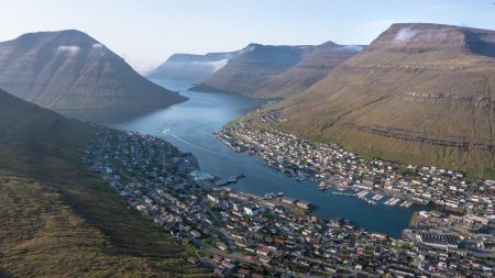
The Faroe Islands are approximately 320 km (200 mi) north of the United Kingdom and 430 km (270 mi) southeast of Iceland. The islands’ nearest inhabited neighbor is the Scottish Shetland Islands, situated roughly 285 km (177 mi) to the east.
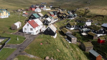
The Faroes are composed of 779 islands, islets, or skerries. There are 18 major islands, including the uninhabited Lítla Dímun. The entire group encompasses an area of approximately 1,393 sq km (538 sq mi), with no significant rivers or lakes. The landscape of the Faroe Islands is mainly rocky plains and low rugged mountains with no native forests. Of the islands’ 433 peaks, none exceed 900 m (2952 ft) in elevation.
Geology
The Faroe Islands consist of 6 km (3.7 mi) thick volcanic basalt interspersed with thin strips of tuff (volcanic ash). The islands formed around 55 million years ago during the Paleogene period.
The basalt exists in three distinct layers; each layer signifies a different significant volcanic eruption during the Paleogene.
Located on the Eurasian tectonic plate, the Faroe Islands began to form when Greenland and Europe separated, opening up the northeastern Atlantic Ocean. During this time, large-scale volcanic eruptions built up substantial basalt layers covering sizable areas from the Faroes and Rockall, a small islet located 692 km (430 mi) south of Iceland.
Source: visitvagar.fo


Reviews
There are no reviews yet.