
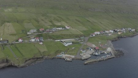


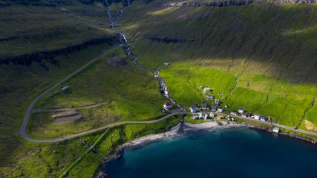
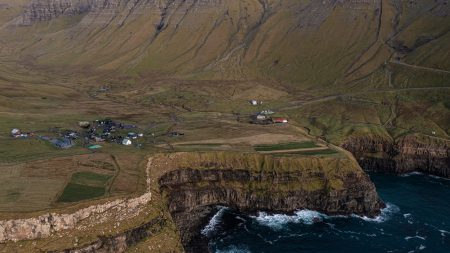
Hov is a village located on Suðuroy’s east coast, in the Faroe Islands; it is frequently mentioned in the country’s history.
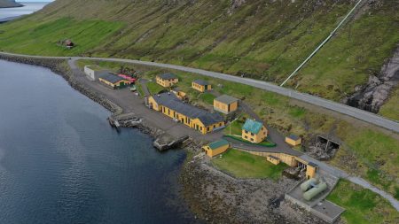
Salmon sea farming has been practiced in Hov since the 1980s. North of Hov along the old road to Øravík are interesting basalt columns that march along the hills.
The Church
The wooden church in Hov was originally built in Vágur on Kirkjukletti in 1862. It was moved to Hov in 1942. A new church was built in Vágur, it was ready in 1939, after that they could start to take down the old church and move it to Hov, as it was promised 25 years earlier in 1914.
Hovstunnilin – The Hov-Øravík tunnel
In 2007, the road tunnel “Hovstunnilin” opened. In addition to connecting the villages of Hov and Øravík, it connects the southern and the northern parts of the island. It is no longer necessary to drive over the mountain, which can be difficult in wintertime. Now, it takes only 20 minutes to drive from Tvøroyri to Vágur. The tunnel is 2.5 km (or 1.55 mi) long.
Viking History – Viking Chief Havgrímur
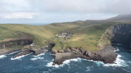
According to the Faroese Sagas and local tradition, the first Viking settler on Suðuroy established a farm in Hov, which is said to be named after his pagan hof. His grave is at “undir Homrum” in Hov and is the only chieftain burial site to be found on the Faroes. Hov lies in the middle of the island and the area is flat and wide with a good view out to sea. This enabled Suðuroy’s first settlers to follow exactly what was happening on the sea around.
The viking Havgrímur who was chief of half of the country lived in Hov in the 10th century.
His burial plot is located in the hills above the village, but was largely destroyed when opened in by amateur archaeologists in 1834.
The area west of Hov
West of Hov is a waterfall with the name Foldarafossur. It lies in Hovsá, which runs from Vatnsnes and is the line of demarcation between the villages of Porkeri and Hov. The waterfall is formed at the place where Hovsá runs over the edge at Foldarshamri, and a bit further to the south there is a mountain pass which is called Foldarsskarð. These three place names all have the same origin, and linguists think that the name comes from the soil (in Faroese also foldin) below these localities.
Approx. 30 years ago, the electricity company SEV commenced construction work in Hovsdal, so that the hydropower could be converted into electricity, and a dam was built approx. ½ km west of Foldarafoss. Therefore, the waterfall does not have the same power as before, but if it rains a lot, and water flows out over the dam, the waterfall may show some of its old power.

Reviews
There are no reviews yet.